WEDNESDAY JUNE 15TH


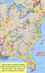
Departed Orillia with the plan to stop short of the Big Chute for the night and tie up at the Government docks. We took one look at those when we arrived and continued on to Big Chute.

Geologists claim the bottom at the north end of Lake Couchiching rises 1 foot per century. What I find fascinating is the reason this is happening is the land is rebounding from the pressure put upon it some 12,000 years ago by glaciers!

The predominant species of birds on this lake appear to be cormorants. We saw this island from a distance and thought it looked frost covered.  As we got closer we could see the trees had many cormorants in them. Almost every square inch of the trees and island was covered with their droppings.

We spent part of the day on Lake Couchiching. It is a big area of water, but not without it’s rocks. There is a section of buoys here that the locals refer to as “the bowling alley”. One can understand why. It reminded us of my dad’s expression of “keep ‘er between the fence posts”.


The day was going well until we had to stop and wait for this decrepit old railroad bridge to be open. It is normally open and wouldn’t you know they were working on it. A 15 minute wait turned into half and hour. Not a big deal, but this is a narrow area we are in not much margin for error to have to hover around in.


While waiting we did see quite a bit of wildlife. A muskrat swam by and also this huge snapping turtle. We could see the start of a beaver lodge. I think the builder was evicted earlier because none of the sticks looked very fresh. You can understand why we wouldn’t want to get our props tangled in this.


When they could finally swing the bridge for us it made a deafening, metal on metal screeching sound. I believe the bridge is at least 100 years old, and I’m thinking someone forgot to oil it.

We passed though areas today that look just like the boundary waters of Minnesota.


This shot is as we entered McDonald’s Cut. This is an example of the many narrow rock lined cuts that took so long to complete in order to make this area navigable. The work would all been done by hand, and probably some explosives as there was no machinery in 1905 when this was done.


Another not so very fun spot that Ross had to navigate the boat through. It’s the Flat Rapids. They perhaps don’t look like rapids, but the water was swirling and squirrelly making it difficult to control the boat. And you can see from the picture, he had to keep it to the left of the green markers. Which put us very close to shore! You will have to double click on the photo to see what I'm talking about.

We were relieved to arrive at the Big Chute for the evening.


After the long day of boat driving, the skipper needed ice cream!


 Before.


After.


Our fellow Minnesotans in the SOUTHERN BELLE showed up also and we had the entire docks to ourselves.


This was the view at dusk that we shared off our back decks.

TUESDAY JUNE 14TH, 2011


A bright sunny day.

The locks don’t open until 9 a.m. which makes for a relaxing start to the day. Just before 9 we pulled out of Bolsover and headed for Orillia, which is at the north end of Lake Simcoe


Today we had 5 locks to go through. Many of the locks are out in the middle of farm country. Notice the dirt path along the waters edge.


Many of the tenders at the locks run from to lock to lock at this time of the year. A path runs along the water way and they travel it by golf cart.


The locks came in quick succession, then it was out in the big water of Lake Simcoe. This is water Ross and I feel comfortable on! Add to it the sunshine and the water only having ripples, well we were loving it.


We have been traveling on and off with the SOUTHERN BELLE. Chris and Kerm Wold of St. Paul own her. It’s been fun having some local Loopers to be with. Kerm’s sister, Mary Ann, and brother-in-law, Cecil, are with them. And ya, you betcha its fun to get together for happy hour don’t ya know?

They were a little ways behind us coming out into Lake Simcoe. Kerm asked us over the   radio if we had stopped and reversed the engines to get rid of weeds. Ross responded yes. Kerm said there was a  mass of chopped up weeds about 30 feet across! Dang weeds. No wonder they slow the boat down.

MONDAY JUNE 13TH, 2011

    
On the move again. Today’s journey took us from Bobcaygeon to Kirkfield.

If you look at the map you will see that today we passed through the lock at Rosedale. It was a lift of only about 4 feet, but this put us at 840 feet about sea level. From now on when you follow us on the map you’ll notice the V indicating the lock is going in the opposite direction. From here on we get lowered in the locks. Remember that you can click on any of the pictures to make them larger.

After spouting off the other day about the Canadians and how they don’t fly the flags of other countries, well folks I now have to eat my words.  But eat them I will, and enjoy every bite!


The trip today was 38 miles. Much of it was very stressful boating through canals so narrow that often the evergreen branches brushed the sides of the boat.


There are rock walls on either side and we were on pins and needles most of the day expecting to hear the props hit something.


With the canal being so narrow, the last you want to do is meet a boat. Muchless two. Ross just held the boat in a spot where it was just little less narrow than the rest of the canal. We held our breath and let them pass.


After slowly traveling the canal you come upon the Kirkfield lock. It seemed like a big giant standing there after being in the narrow shady canal.


It is like the lift lock at Peterborough, only this time we will be going down. So we drove into the upper pan. Creep factor was off the charts!!! If you look directly ahead of the bike handles in the photo you will see the canal where we are headed. Way down below! (you may have to click on this photo too in order for it to be large enough to see what I am referring to)There were no malfunctions with the lock on the way down so we made it safely. Believe me, our imaginations where running wild with “what if’s”.

We left the giant behind and continued back on a narrow canal. We figure they must have built the lock first and then only had enough money left to dig a very narrow canal.

Once through the canals we had to wind our way through a shallow extremely weedy lake. The props would have so much weed wrapped around them we would barely be chugging along. Ross would run them in reverse to throw it off and we’d be moving again.

And then there was Hole in the Wall bridge!!!!
 
We read that it is very shallow in this area. So shallow that we pumped the holding tanks, ran our water supply down and haven’t taken on fuel so we sit higher in the water.

The depth only got down to 1.8 feet so we had plenty of room! As long as you don’t hit the bottom, there’s plenty of room.


We were glad to arrive at our destination and relax.

SUNDAY JUNE 12TH, 2011

We are on our way to the Burleigh Lock. Our plan is to travel today as far as Bobcaygeon. First we must pass through Hell’s Gate. We didn’t have any problem. Just went slow and kept her between the markers. But just to be on the safe side, Skipper sent me up on the bow to keep a look out for rocks.


Just before getting to Hell’s Gate we passed this church on a rock island. It is the St. Peters-on-the-Rock Anglican Church. Built in 1914 it still holds services each Sunday during July and August. There’s a dock for cottage boats who attend.


It is beautiful up here. I have probably said it already, but it reminds us very much of northern Minnesota. Here’s a just a few of the cottages we saw today. Not only are the “cottages” incredible, but the gardens, landscaping and stone work look like something out of a magazine.


We kept ourselves entertained looking at the many mansion-cottages. Wow!


One of the very narrow spots we had to pass through.


We passed this house on Stoney Lake. Designed by some fancy smancy architects called GH3. It's all made of glass. The inside walls and everything. Again, I ask why???


We arrived in Bobcaygeon early enough in the day to walk around and check things out. At the marina they told us Bigleys is THE shoe store. Everybody goes there. So we figured we better go there. Didn’t buy anything and continued on our way. But the store has been family run since 1911 and is known for the immense number of shoes they carry along with clothing and over 12,000 swim suits.


Wouldn’t you know it?  Ross and I ran into another Biker Rally! Maybe it’s an omen that we are supposed to get Harleys, but I can’t imagine so. I can barely be trusted to ride my bicycle without wiping out.


Not that I’m an expert by any means, but I feel I’ve been at enough Bike Rallies now to see that there would be a huge market here in Canada for airbrush painting and customize work. The ONLY bike we saw with any customized painting on it, (and it wasn’t anything too fancy) people were taking photos of and oowing and aawing over it.

SATURDAY JUNE 11, 2011


The lock at Burleigh Falls is still not open, so we are stuck here at Youngs Point. Things aren’t all bad though, a blues fest starts here today at 11.


The Blues Fest is on the grounds of the General Store right next to the lock and canal. How convenient is this?? The sun is out and the people are coming with coolers and lawn chairs.


Brian’s Not Just Blues Fest is in honor of a guy name Brian Holmes who owned the General Store here. He died in 2003 from cancer. He must have been a much loved man because volunteers raise thousands of dollars every year in his name for charitable organizations.


This year the proceeds go to the Gainey
Foundation. Not being a sports fan, Ross explained to me that Bob Gainey is to hockey what Harmon Killebrew is to baseball in Minnesota. He was at the Blues Fest and auctioned off some hockey jerseys. Anyway, the foundation is in honor of his wife who died of a brain tumor. And in honor of his daughter Laura who at the age of 25 was a crew member on a tall ship sailing from Nova Scotia to the Grenadas. It was late in the year and the ship was caught in a bad storm during which she was swept overboard and lost. Not wearing a safety harness or life jacket. Very sad. The Gainey foundation supports environmental arts programs for youth.


People had a great time and stayed all day, despite the pouring rain at one point.


The music and food went from 11 a.m. to 5 p.m. This guy was one of my favorites. I think he’s singing the blues because the only clean shirt he could find to go with his plaid shorts had stripes. This guy has got to be a bachelor who doesn’t live at home because no woman would let him out of the house wearing this combination.

Late in the day we found out the power had been restored to the Burleigh Falls lock so we will moving on in the morning.

FRIDAY JUNE 10TH, 2011


We left Peterborough with a plan to reach Burleigh Falls by the end of the day.

That plan was cut short when we learned the hydro (power) still wasn’t back on at the lock in Burleigh Falls from the storm the other night. Our second lock of the day was the Peterborough lift lock. It’s the largest hydraulic lift lock in the world. Built between 1896 and 1904, it was one of the world’s largest concrete structures. And that’s just concrete, not reinforced concrete. Reinforced concrete was just starting to be used at this point and most engineers were very skeptical of it.


I can only describe this lock as amazing! There are two large chambers, or tubs filled with water. We drove in to the lower chamber and tied up. Then they fill the chamber that’s way up in the air with an additional foot of water. This foot of water adds 144 tons of weight to that chamber. Being it weighs more, it lowers and raises the chamber we’re in. There’s some hydraulics going on too, but I don’t begin to understand that enough to explain it.


Once we were in the chamber on the left side of the lock, it looked like this.


Its fast and only took us 10 minutes to go from bottom to top. 65 feet. Here’s what it looked like out of the back of the lock up at the top. Pretty amazing, eh? (did you catch my Canadian accent there?)


This is a link to a YouTube video if you want to see the lock in action. If you click on the underlined part it should bring you directly to the YouTube video of the PETERBOROUGH LIFT LOCK

We stopped for the night at Youngs Point and tied up along the lock wall. Maybe the Burleigh Falls lock will have power tomorrow and we’ll be able to move along. If not, we’ll wait. There is not power here for us, or Internet so we feel out of communication. The boat ahead of us on the wall is from Toronto so they are able to call the lock and find out what’s happening and then they share info with us. Just have to go with the flow.

THURSDAY JUNE 9TH 2011


Today’s lesson: Canoes and the Canadian frontier.

We spent the good part of the day doing boat chores. Toward mid afternoon we decided to take a walk and check out the Canoe Museum.

The museum began at the beginning, as we know it anyway. The Canadians refer to their native population as First Nation or aboriginals. No offense to anyone but I will refer to them as natives. Only because I am a poor typist and native is easier for me to type.


Being from Minnesota I figured all canoes looked like the Ojibwa canoe. Shows what I know. This map shows the bow shape of various canoes depending upon where they lived in Canada.

The Ojibwa canoe was made of a frame of white cedar, maple, beech and ash with a cover of white birch bark stitched together with spruce roots and coated with a mixture of spruce gum mixed with bear grease and charcoal.


This one is styled like a Kayak and has a flat bottom. Gwich’in tribe.

It didn’t take long for the first Europeans who came to Canada in 1603 to realize how unfit their vessels were for travel on the “turbulent rivers and heart stopping rapids” of the country. But the canoe was a perfect design.


Luckily for them, the natives shared not only their knowledge of canoe building but also of the canoe routes. This is a hand drawn map from 1810 drawn by a native Canadian for the Hudson’s Bay Company.


What started it all. Beaver skin hats.

The natives did the trapping. But it was the Voyageurs who did the traveling and the trading. Bringing back the furs to Hudson Bay. Which ultimately went to England where they used the soft undercoat of the beaver to make a felted man’s hat.


The Voyageurs had no time to stop to hunt or fish so half their cargo was their food. I’m sure you’re wondering what they ate? Well, it was pemmican. And here’s the recipe:

Buffalo meat cut into flakes or thin strips
Dry and then pounded to a pulp
Put pulp on a large piece of hide
Add boiling buffalo fat
Add Saskatoon berries (optional)
Then sew up bag and seal with tallow

Like me, you probably are wondering how it tasted. Well it was described as this, “take the scrapings from the driest outside corner of a very stale piece of cold roast beef. Add to it lumps of rancid fat, then garnish with long human hairs and short hairs of dogs and you have a fair imitation of common pemmican”. Maybe the Saskatoon berries would help? Just a thought.


Voyageurs need 5,000 calories a day to work efficiently. At 50 paddle strokes a minute and 30,000 in a day I can certainly see that. 5,000 calories is the equivalent of 11 Big Macs. Ross wondered if they went to the “paddle through”.


The Voyageurs traded many things but one of the most famous are the Hudson Bay blankets. The value of the blanket was determined by it’s size and weight.


The stitching on them designated the size and weight of the blanket without having to unfold it. The stitches did not designate how many beaver skins it was worth. Beaver skins varied in quality. The higher the quality, the more it was worth in trade for blankets.


Carvings from caribou bone. The ones with the whiskers are really something.