THURSDAY AUGUST 19TH

A cool and hazy sunrise. But all systems are go for traveling the last section of this leg. Cape May, New Jersey is our final destination of this leg. We return to Minnesota on Sunday.

We finished traveling through the C&D canal passing under numerous bridges. This is a railroad bridge. If there had been a train coming, it would have been lowered and we would have had to stop and wait for the train to pass.


I thought these two bridges made for a neat visual.

We entered out into Delaware Bay and started to see dolphins and jellyfish before long. In other words, the water is salty again. And will continue to become more so as we head toward the Cape May and the Atlantic.

We could see the Salem Nuclear Power Plant from miles away. The plume coming out of the chimney is water vapor, not smoke. I wonder if Homer Simpson is working today?

Bruce Willis worked as a security guard at this power plant before he pursued his acting career.

The Delaware Bay is a large expanse of water and is wide enough that we are out of sight of the land. The water was calm today with just a ripple on it. Much different from how it was behaving yesterday. Really glad we waited till today to travel it.

WEDNESDAY AUGUST 18TH

We got up early with hopes to continue on to Cape May, New Jersey. This would involve several hours traveling on the Delaware Bay once we are out of the C&D canal.

It was already raining when we got up. Ross checked his various web sites for weather and wind and decided we should probably wait until tomorrow to leave. If he had any second thoughts, he didn’t when the marina we were headed to called him and said “don’t come, the weather is horrible!” Thunderstorms, big waves and wind is not what you want when traveling a big open body of water like Delaware Bay.

So the day was spent reading, napping and watching old black and white reruns of The Twilight Zone, Bat Masterson and The Rifleman. My kind of day!

TUESDAY AUGUST 17TH

An early start again as we are headed to Chesapeake City and the city free docks. Its first come first served so we need to be the early birds. Lucky thing too, because we barely fit in the space available when we arrived.

The scenery has changed as we leave the Chesapeake and travel up the river. This is Turkey Point lighthouse, which marks the start of the Elk River! (Elk River is where I grew up, but in Minnesota) What I found interesting about this specific lighthouse is that a keeper’s wife tended it for over 20 years after he passed away. And when she got old, their daughter moved in and tended the light for another 24 years. There was also another older woman who tended the light for many years after that. It looks like there has been enough erosion along the riverbanks that the lighthouse is about ready to topple in.


The area along the Elk River is rolling and green. We see many farms along it. What an amazing view these farmers have while working the fields.


We are leaving the Elk River and entering the C & D canal. It is a manmade 12-mile long canal connected the Chesapeake Bay and the Delaware Bay. It is the 3rd busiest canal in the world and shortens the travel time (for ships) between Baltimore and Philadelphia by 13 hours.


The canal was built back in 1829. At that time it was 10 feet deep and 36 feet wide at the bottom. It was also operated with a series of 4 locks.

This is one of the steam engines that turned a huge wooden wheel that filled the locks. Mule teams or horses would pull the ships along through the canal.


Later the canal was deepened and widened to accommodate larger vessels. It is now 450 feet wide and 35 feet deep. This is a photo of a “deep cut” barrel. When the widened the canal, the dirt would slide back down the bank into the channel. Workers would fill these barrels with that dirt and pull them by a rope back up a 90 foot slope to the top and empty them. Over 375,000 cubic yards or dirt were removed this way. I have no clue as to how many barrel-fulls that would equate to, but the amount of labor involved is mind boggling to me!


Our destination today is Chesapeake City. I know I have over used the word picturesque, but this place IS picturesque. It is more like a village and filled with quaint old houses. Many are now B&B’s.


We are tied up at the city free dock. We pay $15 a night if we want power. Yes we want power/air conditioning! Next to us is a park and there was a painting class going on.

We rode our bikes to the C & D Canal museum. It is housed in the original buildings which controlled one of the locks back before the canal was improved.


As we left the museum there was a flowering shrub that was covered with butterflies. Most all of them were Swallowtails, but there were a few Monarchs. Amazing little creatures, and so beautiful.


I can’t express the overwhelming enormity we felt watching this ship pass though the canal. We were sitting up on the fly bridge and the photo doesn’t do it justice. This is the same ship we saw the other day when we left Baltimore and the pilot boat was along side of it.


You can tell a bit better from this angle how much the ship fills the canal.

It took us over 3 hours to get here today by boat. A couple we met last night at Georgetown drove over here in 15 minutes. Barbara and Robert from the boat Come Aweigh, joined us for dinner at the Bayard House. Robert at one time did some modeling and is an ex-Marlboro man! He’s giving me the “Marlboro look” for the picture! And no, he doesn’t smoke and can’t even stand the smell of it. We had a fun evening and a very good meal.


The restaurant we had dinner in was built in 1780 and is the oldest house in town. It was turned in to a tavern in 1829. That’s the same year the canal opened.


The Bayard House's local claim to fame is The Hole in the Wall Bar. The name comes from a hole in the wall behind the bar where blacks could only be served by reaching their hands in for a drink. They would not have been allowed inside.

MONDAY AUGUST 16TH


We left Baltimore as the sun was rising. Possible severe storms expected later so we are getting an early start. The water taxis were already starting for the day.

Baltimore was a fun stop, but it is nice to be leaving the waters of the inner harbor. With the recent heavy rains the garbage in the streets has washed down the storm sewers, which empty into the harbor. And into the marina we are staying in particular. Leaves, bottles, styro containers, plastic coat hangers, sections of 4 x 4 posts, bags, garbage, you name it. It’s totally disgusting! We have noticed a boat that goes back and forth in the harbor with a mechanical device on its side, which we think, sweeps the water for trash. No way to operate that in the marina, so we have to wait for the tides to wash it away.

From the harbor we could see this sign perched on top of a building. Turns out its Natty Boh. He’s the unofficial mascot of Baltimore. He even has a website where you can buy stuff with his face on it. His name comes from the National Bohemian Beer Company started in 1885. Miller Brewing now owns it. One of Boh’s products was Colt 45 Malt Liquor.


Baltimore being a very large port has ships from all over the world coming in. It is a local “pilot” who is brought out to each ship and he/she takes over command and brings the ship in. Along with tugboats who push and guide it. A Pilot Boat brings the pilot out and they have to climb up a ladder that the ship crew lowers down.


It was calm out this morning, but I imagine this can get fairly hairy at times. This is a full sized view of what they are doing. No thanks!!


Today we traveled 47 miles up the Chesapeake to  Georgetown, Maryland. The water is less salty, and dirty, as we made out way. The color of it changed and even the smell is fresher. Smells more like a river again.

The crabs must like this water because there were crab pots everywhere!! I think it’s the densest area of pots we’ve encountered. Most pots are thrown out in long straight lines so you can make a course adjustment. These were scattered willy nilly about 30 feet apart. Our boat is 15 feet wide so it made for some wild driving. The waves and the dark color of the floats made them really tough to spot. I’m still amazed we didn’t wrap one around our prop.

Georgetown is located on the Sassafras River. It is gorgeous!! “Wish we had more time and cooler weather so we could enjoy the beauty of the place”….Roscoe

There are many back bays to anchor, sandy shorelines, hills, birds, and I’m guessing good fishing from all the little fishing boats we see. The air smells fresh. And you can actually swim in these waters. No jellyfish.

It’s easy to understand why there are so many marinas here. It is well protected from weather and fresh water is way easier on your boat than salt water. The predicted storms passed to our north. Dodged another bullet.

The roof over the slips in the picture had the roof collapse on it last winter because of the weight of snow. I think they had something like 60 inches of snow fall within a week or so.

SUNDAY AUGUST 15TH

A rainy day in Baltimore.

Took the day off!

SATURDAY AUGUST 14TH


My cousin, Janice Magnuson, lives in Alexandria, Virginia. I don’t get to see her very often and I am excited that she is driving up to Baltimore to spend the day with us!!!

She picked us up and we went out to Fort McHenry. Shortly after we arrived there was a short film that they showed about the history of the fort and the battle which moved Francis Scott Key to write the poem which would become our National Anthem. As the film ended and the Anthem was being sung, a heavy curtain on the wall was retracted exposing a glass wall. Behind it was this scene. It was very moving.

We walked around the Fort, which has been in use since the famous battle in 1813. It was used during the Civil War to control the townspeople. There were local southern sympathizers who attacked Union soldiers from Massachusetts as they changed trains in Baltimore killing several soldiers. The Union put cannons up on fort and aimed them toward the town as a threat against any more riots. The fort was also used as a hospital during WWI.

General George Armistead was the commander here and wanted a flag large enough so the British could see it from the water and have no doubt that it was American. He hired a local seamstress named Mary Pickersgill to sew a flag 30 feet by 42 feet. That is a huge flag!!! The original flag is currently in the Smithsonian being restored. My cousin told me that workers are suspended over the flag to work on it. They are removing the linen backing, fiber by fiber, that had been added to it at a later date.

A park Ranger was giving an information talk so we wandered over. It was mostly about the flag. The photo above is not the size Mary Pickersgill sewed though. The Ranger had a replica flag of the original and had everyone there help roll it out.

Ross and Janice as the flag is being rolled out.


Big flag, huh? I can’t imagine sewing this. The original flag was made out of wool.


We walked though the various buildings and they had some nice displays. This shows what the barracks of the enlisted men would have been like. 4 soldiers to a bunk! I suppose 2 of them would be on duty and 2 off? Hope so or it would be tight quarters on the bunks.


There were some re-enactors who were playing music and dancing. They would answer any questions. Would should have asked, but Janice and I kept wondering who picked the color white for the trousers, and how did they keep them clean? Guessing they probably didn’t.


After the fort we went to Felling Point, an area close to the harbor. We had a nice lunch in the garden area of One Eyed Mike’s.


We the strolled around Felling Point. Lots of pubs, eating establishments, and shops. Of course we decided we needed ice cream so stopped in at Maggie Moo’s. Janice treated.


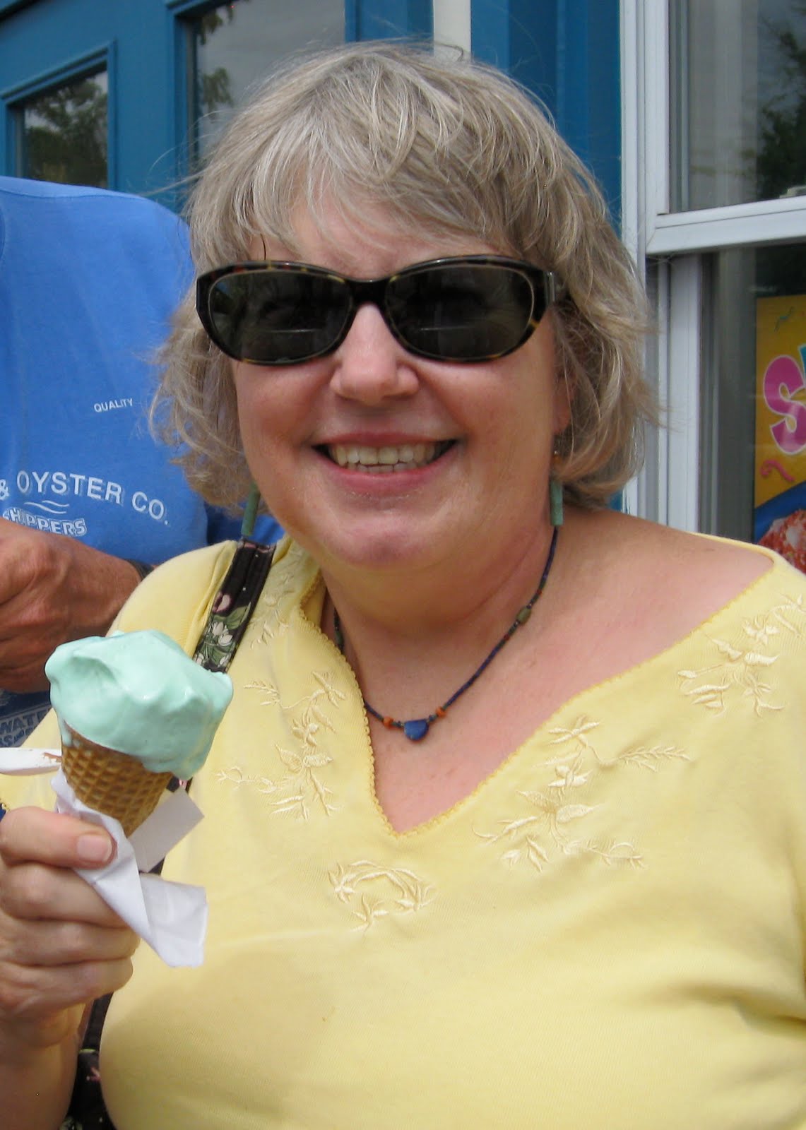
Ross being a Hiner, would there be any doubt what flavor he’d choose once he saw this?


Janice chose pistachio and Ross is trying to swipe a taste.


There are water taxis that run to various stops all over the harbor. For $10 bucks you can ride all day, unlimited stops. This was just one of the stops and the tourists are boarding here. We walked.


Before Janice headed back to Alexandria and to her kitty, Peter Pan, she stopped on board to see the ODDYSEA.


She looks right at home at the wheel.


Later on the evening Ross and I walked up to Little Italy. It is an area that has generations old row houses. Some which have been passed down and are still in the same families. There are family operated restaurants everywhere, and oh does it smell heavenly!


Our noses led us to Sabatinos. Not sure, but we think the guy at the next table was from the Soprano family!!!


Just kidding, but he sure looked and sounded like it.

FRIDAY AUGUST 13TH


Happy 33rd Anniversary to us!!!!!!!!!! The day I married Ross, I never dreamt we’d be doing a trip like this.


Once again we crossed back across the Chesapeake Bay.  Our destination being Baltimore. It was a rock and rolly crossing. Our course and the direction of the waves made us take the waves from the side. I try to set things on the floor that I think may tip, but always seem to forget something. Nothing serious though. Usually a stack of magazines or something.


Coming into Baltimore we could see huge shipyards where they unloaded container ships. As far as we could see there were stacks and stacks of containers. Wonder what all is in them? One of our favorite television series was The Wire. The series took place in Baltimore and one year the plot revolved around the container ports. Ross thought this one looked like the same scenery from the show.


We passed the naval hospital ship, COMFORT. This ship most recently was in Haiti, following the earthquake. Operation Desert Storm, 9/11, and Katrina are amongst a few of the places this ship has gone to help out as a hospital.

you may need to double click on this photo to see what I am referring to
As you enter the harbor, you immediately notice this hill with green grass. Everything else is so industrialized that it really stands out. This is Fort McHenry. During the War of 1812, the British made a failed attempt to take over the Fort. (losers!) Out in the harbor on a truce ship, Francis Scott Key was being held until after the battle. He was a lawyer and went out to negotiate the release of an American doctor. This marker in the water indicates the place that ship was when Key wrote the poem that would eventually become our National Anthem. That poem was later put to the tune of a British pub song. How ironic!

It had become quite windy by the time we arrived at the marina in Baltimore. When Ross radioed in our arrival, he was informed that they didn’t have any dockhands to assist us. (oh goodie) It was somewhat of a rodeo and took several attempts, but we made it. Wind to a powerboat is an enemy.

Baltimore is very tourist friendly in that it has a boardwalk area that runs something like 7 miles along the waterfront. There are restaurants and pubs, shops and sightseeing all along it.


We took a walk and come across the United States Coast Guard Cutter, TANEY. It is the last surviving ship of Pearl Harbor.


The old coal burning power plant has been converted into stores. We went in the Barnes and Noble. Very cool.


You can see one of the old chimneys behind the escalator. The escalators looked like a coal conveyor belt. The inside of the building was left pretty much as it had been. And yes, we bought a couple of books.


Further down the boardwalk was the U.S.S. CONSTELLATION.


We enjoyed dinner and a bottle of wine on our back deck to celebrate our anniversary. It was a nice evening and very scenic watching the city light up. This is one of our night lights.